The Way Back Machine: Neighborhood Planning and the South Park Bridge
This is part of a series looking back at 20 years of land use, planning, and housing policy history leading up to the state we’re in today. Here’s the story of a neighborhood win that took many years to achieve.
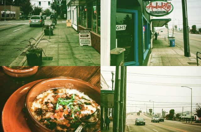
A Big Mess: The South Park Bridge
South Park is largely cut off from the rest of the city by the Duwamish River but connected by a drawbridge. By the 1990s the old drawbridge, built decades earlier, was falling apart and nearing the end of its life, sometimes getting stuck in the up position. It was a problem and getting worse. And everyone in the world was worried about it. Yes. Everyone. See the Duwamish is considered an international water way and the federal government and the Port of Seattle needed that section to be open for ships and freight to pass through; if for some reason it got stuck closed there were far wider marine implications for the Army Corp of Engineers and the Port.
If the bridge got stuck open, the consequences would be equally disastrous for land freight. The South Park Bridge was a choke point for freight originating from the south traveling north and trucks needing to go south from the Duwamish industrial area toward Highway 99 and Interstate 5.
For the neighborhood businesses and residents it would be equally damaging. Bus and emergency services would be impacted. Customers walking or driving over the bridge would be cut off from the restaurants on 14th. And Sea Mar Community Health Center patients would be cut off from the primary care and dental clinics as well as the day care and nursing home.
Not complicated enough? The bridge started, from the north in Seattle but landed in the south, on the other bank of the Duwamish, in unincorporated King County, a small section of the map called “the Sliver by the River.” Each of the governments did not want to pay for the fix for the bridge, whatever it was. The County didn’t have the money and neither did the City. The federal government wasn’t stepping up either. Who would pay for the bridge? Who was responsible for dealing with the fix? Both governments pointed to the other one.
Let’s add another twist. Sometime in the 1990s a neighbor applied, successfully, to get historic landmark status for the bridge, meaning that the structure would be protected from outright demolition.
Then along comes neighborhood planning.
If ever there was a situation that called for a top down solution, this was it. If some power on high showed up with money and a mandate, the problem could just be solved. But the last thing you’d want to do is invite a bunch of lay people with no engineering expertise or legal knowledge into the process. But that’s exactly what neighborhood planning did.
The expert solution was a fixed span bridge that would have landed right in the middle of South Park’s business district, at 14th and Cloverdale. This was the cheapest and most efficient solution the experts argued. The span had to be tall enough for taller ships to pass and that meant the geometry would require wiping our most of the buildings and existing roadways in the neighborhood. Various public outreach meetings were held in the 90s asking for reactions to various proposals. I remember one in which various versions of the fixed spans were marked, “A” and “B” in descending order of the alphabet. Maybe I’m wrong about this but way toward the end of the letters of alphabet was the drawbridge.
Of all the many items in the plan a new library (another thing eye rolled by the experts) and the drawbridge solution were at the top of the neighborhood’s plan. And there it stayed as successive neighbors came and went between the time of the plans start point and the first decade of the 21s century. The plan was the baton, the record, that was handed off year after year, and the demand for it outlived the original groups and individuals – although there was a lot of continuity there too.
After the economic melt down of late 2008, the Congress passed the American Recovery and Reinvestment Act (ARRA) in 2009, a huge spending bill that allocated money for many “shovel ready” projects. I might have the details completely wrong, but funding was finally identified in 2010 and the project for the drawbridge got underway. It took four years, but the new drawbridge opened in 2014.
Next: The Beacon Hill light rail station and neighborhood planning.